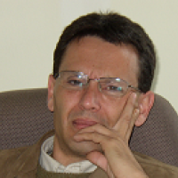
Francisco Eugenio González


Additional information: 
Description: 

Francisco Eugenio (M’00-A’00) received the B.S., M.S. and Ph.D. degree from the University of Las Palmas of Gran Canaria (ULPGC), Las Palmas, Spain, in 1986, 1993 and 2000, respectively, both in on Electrical Engineering. He joined the Department of Signal and Communications, ULPGC, in December 1988. From 1998 to December 2000, he was with the Technical University of Catalunya in Barcelona (UPC), Barcelona, Spain, in the image processing group. Since 2003, he is Associate Professor at ULPGC, having served as Associate Dean of the Telecommunication School (EUITT) at ULPGC (1994-1999). Since 2004 he is Dean of the Telecommunication School at ULPGC. He is currently lecturing on the area of remote sensing and radar. From January 2006 he has been elected to the grade IEEE Senior Member. His current research interests include remote sensing image processing, modelling and georeferencing, especially in applied remote sensing in the field of physical oceanography. In these areas, he is author or coauthor of many publications that have appeared as journal papers and proceeding articles. His research is conducted at the Institute of Oceanography and Global Change (ULPGC) and includes multisensor/multitemporal remote sensing image processing and, specially, high resolution multispectral imaging processing of coastal areas.

Research interests: 
  • Remote sensing image pre-processing techniques (radiometric, geometric and atmospheric corrections; cloud detection)
  • Remote sensing image processing techniques (segmentation; feature extraction; motion estimation; classification and image fusion)
  • Remote sensing analysis of data from many sensors and satellites (AVHRR, SeaWIFS, MODIS, MERIS, ATSR, Seviri, SPOT, Landsat, Deimos, Quickscat, Ikonos, Geoeye, Quickbird, Worldview, Aster, etc.)
  • Climate change, marine, costal and land analysis

Recent publications

Mederos Barrera, A., Marcello Ruiz, F. J., Eugenio González, F., Hernández, E. 2022. Seagrass mapping using high resolution multispectral satellite imagery: A comparison of water column correction models https://doi.org/10.1016/j.jag.2022.102990

Eugenio, F., Marcello, J., Mederos-Barrera, A., Marqués, F., 2021. High Resolution Satellite Bathymetry Mapping: Regression and Machine Learning Based Approaches https://doi.org/10.1109/TGRS.2021.3135462

Eugenio, F., Marcello, J., Martín, J., 2020. Multiplatform Earth Observation Systems for Monitoring Water Quality in Vulnerable Inland Ecosystems: Maspalomas Water Lagoon. Remote Sensing 12(2), 284. https://doi.org/10.3390/rs12020284

Marcello, J., Eugenio, F., Gonzalo-Martín, C., Rodríguez-Esparragón, D., Marqués, F., 2020. Advanced Processing of Multiplatform Remote Sensing Imagery for the Monitoring of Coastal and Mountain Ecosystems. IEEE access, 9, 6536-6549. https://doi.org/10.1109/ACCESS.2020.3046657

Eugenio, F., Marcello, J. (eds). 2019. Very High Resolution (VHR) Satellite Imagery: Processing and Applications. MDPI, Basel. https://doi.org/10.3390/books978-3-03921-757-1

Eugenio, F., Alfaro, M., Martín,, J., Marcello, J., 2019. Multiplatform Earth Observation Systems for the Monitoring and Conservation of Vulnerable Natural Ecosystems. IGARSS 2019-2019 IEEE International Geoscience and Remote Sensing Symposium, 8230-8233. https://doi.org/10.1109/IGARSS.2019.8900425

Marqués, F., Eugenio, F., Alfaro, M., Marcello, J., 2019. Bathymetry Mapping using very High Resolution Satellite Multispectral Imagery in Shallow Coastal Waters of Protected Ecosystems. IGARSS 2019-2019 IEEE International Geoscience and Remote Sensing Symposium, 8234-8237. https://doi.org/10.1109/IGARSS.2019.8897992

Medina Machín, A., Marcello, J., Hernández-Cordero, A. I., Martín Abasolo, J., & Eugenio, F., 2019. Vegetation species mapping in a coastal-dune ecosystem using high resolution satellite imagery. GIScience & remote sensing, 56(2), 210-232. https:/doi.org/10.1080/15481603.2018.1502910

Marcello, J., Eugenio, F., Martín, J. Marqués, F., 2018. Seabed Mapping in Coastal Shallow Waters Using High Resolution Multispectral and Hyperspectral Imagery. Remote Sens., 10(8), 1208 https://doi.org/10.3390/rs10081208

Medina Machín, A., Marcello, J., Hernández-Cordero, A.I., Abasolo, J.M., Eugenio, F., 2018. Vegetation species mapping in a coastal-dune ecosystem using high resolution satellite imagery. GIScience and Remote Sensing, 56, 210-232. https://doi.org/10.1080/15481603.2018.1502910

Rodríguez-Esparragón, D., Marcello, J., Gonzalo-Martín, C., García-Pedrero, A., Eugenio, F., 2018. Assessment of the spectral quality of fused images using the CIEDE2000 distance. Computing, 100(11), 1175-1188.
https://doi.org/10.1007/s00607-018-0640-7

Eugenio, F., Marcello, J., Martín, J., Rodríguez-Esparragón, D., 2017. Benthic Habitat Mapping Using Multispectral High-Resolution Imagery: Evaluation of Shallow Water Atmospheric Correction Techniques. Sensor, 17(11), 2639. http://dx.doi.org/10.3390/s17112639

Rodríguez-Esparragón, D., Marcello, J., Eugenio, F., García-Pedrero, A., Gonzalo-Martín, C., 2017. Object-based quality evaluation procedure for fused remote sensing imagery. Neurocomputing, 255, 40-51. http://doi.org/10.1016/j.neucom.2016.06.091

Marcello, J., Eugenio, F., Perdomo, U., Medina, A., 2016. Assessment of Atmospheric Algorithms to Retrieve Vegetation in Natural Protected Areas Using Multispectral High Resolution Imagery. Sensors 2016, 16(10). http://dx.doi.org/10.3390/s16101624

Martin, J., Eugenio, F., Marcello, J., Medina, A., 2016. Automatic Sun Glint Removal of Multispectral High-Resolution Worldview-2 Imagery for Retrieving Coastal Shallow Water Parameters. http://dx.doi.org/10.3390/rs8010037

Eugenio, F., Marcello, J., Martin, J., 2015. High-resolution maps of bathymetry and benthic habitats in shallow-water environments using multispectral remote sensing imagery. IEEE Transactions on Geoscience and Remote Sensing, 53(7), 3539 - 3549. http://dx.doi.org/10.1109/TGRS.2014.2377300

Marcello, J., Eugenio, F., Estrada-Allis, S., Sangrà, P., 2015. Segmentation and tracking of anticyclonic eddies during a submarine volcanic eruption using ocean colour imagery. Sensors, 15(4), 8732-8748. http://dx.doi.org/10.3390/s150408732

Eugenio, F., Martin, J., Marcello, J., Fraile-Nuez, E., 2014. Environmental monitoring of El Hierro Island submarine volcano, by combining low and high resolution satellite imagery. International Journal of Applied Earth Observation and Geoinformation, 29, 53–66. http://dx.doi.org/10.1016/j.jag.2013.12.009

Marcello, J., Medina, A., Eugenio, F., 2013. Evaluation of spatial and spectral efectiveness of pixel-level fusion techniques. IEEE Geoscience and Remote Sensing Letters, 10, 432-436. http://dx.doi.org/10.1109/LGRS.2012.2207944

Calderero, F., Eugenio, F., Marcello, J., Marqués, F., 2012. Multispectral Cooperative Partition SequenceFusion for Joint Classification and Hierarchical Segmentation. IEEE Geoscience and Remote Sensing Letters, 9, 1012-1016. http://dx.doi.org/10.1109/LGRS.2012.2188776

Fraile-Nuez, E., González-Dávila, M., Santana-Casiano, J. M., Arístegui, J., Alonso-González, I. J., Hernández-León, S., Blanco, M. J., Rodríguez-Santana, A., Hernández-Guerra, A., Gelado-Caballero, M. D., Eugenio, F., Marcello, J., de Armas, D., Domínguez-Yanes, J. F., Montero, M. F., Laetsch, D. R., Vélez-Belchí, P., Ramos, A., Ariza, A. V., Comas-Rodríguez, I., Benítez-Barrios, V. M., 2012. The submarine volcano eruption of El Hierro Island: physical-chemical perturbation and biological response. Nature Scientific Reports , 2, 486. http://dx.doi.org/10.1038/srep00486

Marcello, J., Hernández-Guerra, A., Eugenio, F., Fonte, A., 2011. Seasonal and temporal study of the northwest African upwelling system. International Journal of Remote Sensing, 32, 1843-1859. http://www.dx.doi.org/10.1080/01431161003631576

Marcello, J., Eugenio, F., 2011. Vigilancia del Mar desde el Espacio. Investigación y Ciencia, 32-7, 14-15. http://www.investigacionyciencia.es/investigacion-y-ciencia/numeros/2011/2/vigilancia-del-mar-desde-el-espacio-8697

Valencia, E., Camps, A., Bosch-Lluis, X., Rodriguez-Alvarez, N., Ramos-Perez, I., Eugenio, F., Marcello, J., 2011. On the Use of GNSS-R Data to Correct L-Band Brightness Temperatures for Sea-State Effects: Results of the ALBATROSS Field Experiments. IEEE Geoscience and Remote Sensing Letters, 49-9, 3225-3235. http://dx.doi.org/10.1109/TGRS.2011.2159224

Marchan-Hernandez, J. F., Valencia, E., Rodriguez-Alvarez, N., Ramos-Perez, I., Bosch-Lluis, X., Camps, A., Eugenio, F., Marcello, J., 2010. Sea-state determination using GNSS-R data. IEEE Geoscience and Remote Sensing Letters, 7-4, 621-625. http://dx.doi.org/10.1109/LGRS.2010.2043213

Eugenio, F., Marcello, J., 2009. Featured-based algorithm for the automated registration of multisensorial/multitemporal oceanographic satellite imagery. Algorithms: Special issue Sensors, 2, 1087-1104. http://dx.doi.org/10.3390/a2031087

Marcello, J., Eugenio, F., 2009. Telecomunicación Espacial. Servicio de publicaciones de la ULPGC. 237 pp.

Marcello, J., Eugenio, F., Marqués, F., Hernández-Guerra, A., Gasull, A., 2008. Motion estimation techniques to automatically track oceanographic thermal structures in multi-sensor image sequences. IEEE Transactions on Geoscience and Remote Sensing, 46(9), 2743-2762. http://dx.doi.org/10.1109/TGRS.2008.919274

Marcello, J., Marqués, J. F., Eugenio, F., Hernández-Guerra, A. Gasull, A., 2007. Motion estimation techniques of automatically track oceanic thermal structures in multisensorial images sequences. IEEE Transactions on Geoscience and Remote Sensing, 46, 2743-2762. http://dx.doi.org/10.1109/TGRS.2008.919274

Marcello, J., Eugenio, F., Marqués, F., 2007. Evaluación de técnicas de correspondencia de regiones para la estimación del movimiento superficial del océano. Revista de Teledetección, 28, 32-42. http://www.aet.org.es/?q=revista28-109

Eugenio, F., Hernández-Guerra, A., Marcello, J., Rovaris, E., 2005. Regional optimization of an atmospheric correction algorithm for the retrieval of sea surface temperature from the Canary Islands-Azores-Gibraltar area using NOAA/AVHRR data. International Journal of Remote Sensing, 26, 1799-1814. http://dx.doi.org/10.1080/01431160582000298341

Marcello, J., Marqués, F. Eugenio, F., 2005. Automatic Tool for the Precise Detection of Upwelling and Filaments in Remote Sensing Imagery. IEEE Transactions on Geoscience and Remote Sensing, 43, 1605-1616. http://dx.doi.org/10.1109/TGRS.2005.848409

Eugenio, F., Marqués, F., 2003. Automatic Satellite Image Georeferencing using a Contour-Matching Approach. IEEE Transactions on Geoscience and Remote Sensing, 41, 2869-2880. http://dx.doi.org/10.1109/TGRS.2003.817226

Eugenio, F., J. Marcello, J., 2002. Fundamentos de Radar. Servicio de publicaciones y producción documental de la ULPGC. 255 pp.

Eugenio, F., Marcello, J., Marqués, F., Hernández-Guerra, A., Rovaris, E., 2001. A Real Time Remote Sensing Data Acquisition, Processing And Distribution System. IEEE Geoscience And Remote Sensing Newsletter, 120, 10-15. http://www.grss-ieee.org/wp-content/uploads/2009/10/newsletters/archive/sep01.pdf

Eugenio, F., Marcello, J., Hernández-Guerra, A., Rovaris, E., 2001. Methodology To Obtain Accurate Sea Surface Temperature From Locally Received Noaa-14 Data In The Canary-Azores-Gibraltar Area. Scientia Marina, 65, 127-137. http://scientiamarina.revistas.csic.es/index.php/scientiamarina/article/view/708/724

Cubero-Enrici, M., Eugenio González, F., 1991. Análisis Espectral. Teoría y Aplicaciones. Thomson-Paraninfo. 202 pp.